India is moving from post-disaster road repairs to early detection and prevention of landslides on hill highways, using satellite monitoring, drones, slope stabilisation and stronger construction rules, according to a statement by the Ministry of Road Transport & Highways on Thursday, 12 June.
The ministry said the move comes as extreme weather events have increased the risks facing highways in India’s hill states.
It cited last year’s cloudburst in the Dharali and Sukhi Top regions of Uttarkashi, which triggered flash floods, slope instability and caused major damage to human life and settlements.
Why Hill Highways Need This
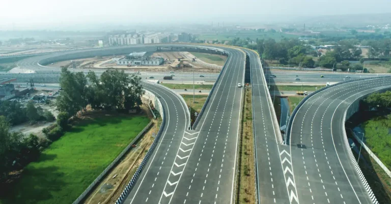
The Ministry of Road Transport & Highways (MoRTH) said nearly 16,788 km of National Highways pass through India’s hill states, out of a total National Highway network of more than 1,46,570 km.
According to the ministry, the Himalayan region is particularly vulnerable to landslides, rockfalls, flash floods, cloudbursts and other geohazards because it is among the youngest mountain ranges in the world.
Mountain highways are also expensive to build and maintain. The ministry said such highways typically cost ₹15-30 crore per km to construct, while a single moderate landslide can lead to repair costs of ₹10-25 crore and disrupt traffic movement for 2-5 days.
What Satellite Monitoring Will Do
MoRTH is deploying satellite-based landslide monitoring and early warning systems along a 100-km stretch of the Char Dham route in Uttarakhand.
The system will use Interferometric Synthetic Aperture Radar (InSAR) technology to detect subtle ground movements and identify vulnerable slopes before major failures occur.
As part of the wider plan, an advanced warning and alert system is also planned on the Parwanoo-Solan section of National Highway-5 (NH-5) in Himachal Pradesh to monitor landslides, land sinking, groundwater movement and rockfall-prone zones in real time.
According to the ministry, these initiatives mark a shift from responding to disasters after they occur to predicting and preventing them.
How Road Construction Rules Are Changing
To improve the sustainability of hill road projects, MoRTH has introduced a phased construction approach.
Under this system, the initial period of about one year will be used only for cutting hill slopes and completing protection works for slope stabilisation.
Road construction will begin only after the slopes demonstrate stability through at least one monsoon season, according to the statement.
MoRTH has also introduced a policy on Normative Construction Periods, providing additional time for projects in the Himalayas, the North-East, the Western Ghats and the Andaman & Nicobar Islands.
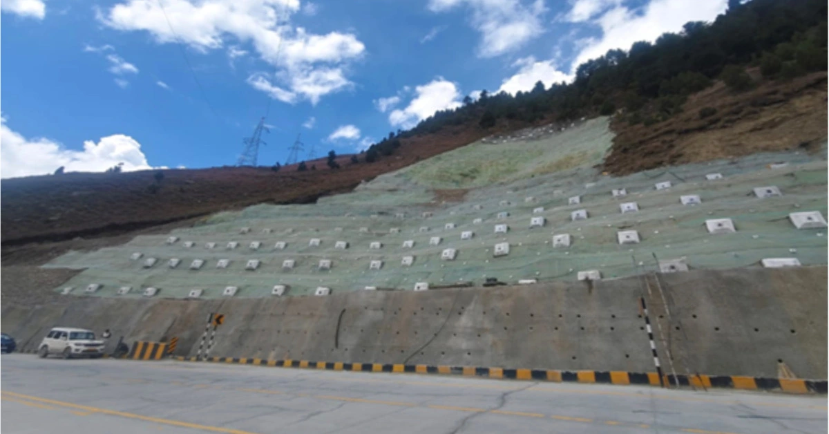
How Slope Stabilisation Works
MoRTH has adopted a scientific and site-specific approach to slope stabilisation, according to the statement.
Engineers will assess each slope based on rainfall patterns, groundwater conditions and geological characteristics before choosing suitable mitigation measures.
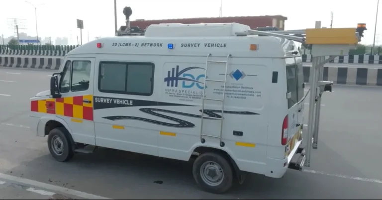
Advanced technologies such as drones, Light Detection and Ranging (LiDAR) surveys and Digital Terrain Models are being used to conduct detailed investigations and identify risks before they turn into major hazards.
Mitigation measures include soil nailing, high-tensile steel wire mesh, prestressed cable anchors, retaining walls and drainage systems to prevent slope failures and rockfalls.
The ministry cited stabilisation works at Karnaprayag in Uttarakhand as an example of how terracing, drainage systems, hydroseeding, rock anchors and retaining structures can improve slope stability.
Who Is Helping In The Work
The ministry said it has strengthened collaborations with institutions including Tehri Hydro Development Corporation India Limited (THDC), Geological Survey of India (GSI), Defence Geo-informatics Research Establishment (DGRE), National Institute of Rock Mechanics (NIRM) and the Indian Institute of Technology Roorkee.
MoRTH has signed an agreement with THDC to undertake specialised landslide mitigation works in Uttarakhand and Arunachal Pradesh.
It has also partnered with DGRE to provide technical expertise and scientific support for assessing and mitigating geohazards along National Highways.
What Is Being Done In Uttarakhand
According to the ministry, 58 landslide-prone locations have been treated in Uttarakhand, while mitigation works are underway at 96 sites.
Detailed project report preparation and investigations are also underway at 104 additional locations in the state.
The ministry said the measures are aimed at creating safer and more resilient transport corridors in India’s hill regions, where roads serve as lifelines connecting communities to essential services and livelihood opportunities.
Read also : UP partners with CSIR-CRRI to roll out road dust control, urban road greening framework in NCR